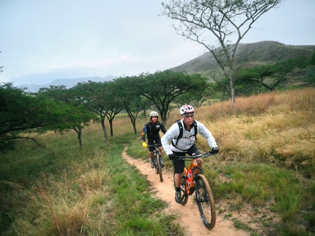
Cederberg Wilderness Cycling is a 9-day Bikepacking tour exploring the Cederberg Wilderness area. It is a World heritage area renowned for its spectacular landscapes, rock formations, botanical diversity and ancient rock art. The bikepacking trip is self-guided with booking service, route directions and maps provided by Trails and Travel but without luggage transfer and support.
You carry your belongings in bike packing bags. An alternative option is to arrange for one or more friends to join the group in a support vehicle. This will take care of luggage and it can be arranged that the vehicle stays within easy reach of the cyclists.
The trip can be shortened by about 28 km to 7 days/6 nights or 8 days/7 nights. It depends on the fitness and preference of the group. Itinerary for alternative options available on request.
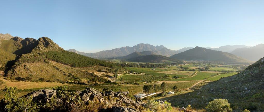
Distinctive Cederberg landscape andmgnificent views and sunsets. The Cederberg is the wilderness at its best.
Flora and fauna
Cape fynbos, endangered Clanwilliam Cedar, Cape mountain leopard, baboons, klipspringers, etc. and more than 100 bird species.
Rock formations
Red sandstone and unique rock formations.
Rock art
Variety of Bushmen rock art produced by the San.
Several activities
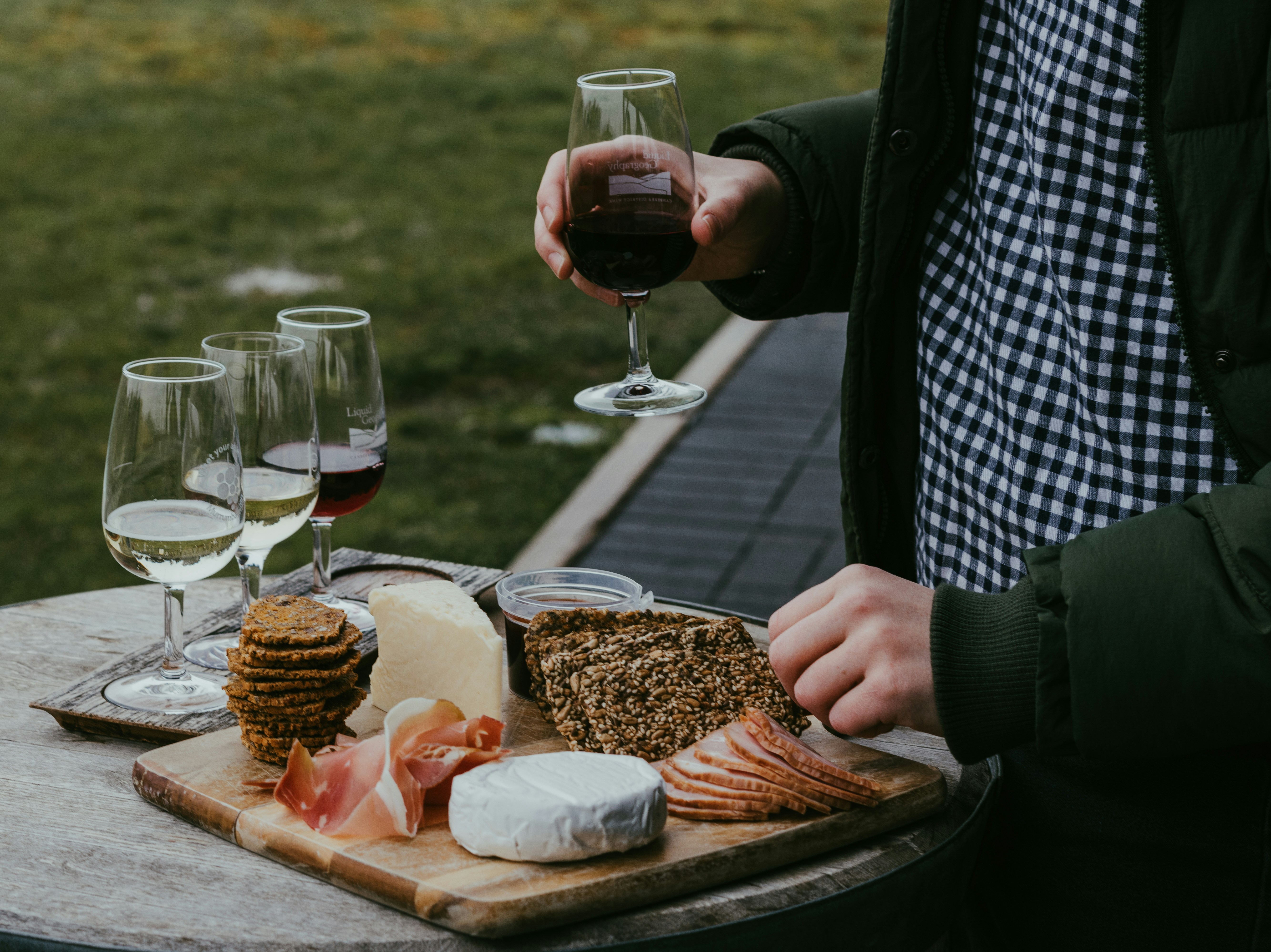
Hiking, swimming, wine- and beer tasting, etc.
Arrive in Citrusdal.
Drive to Citrusdal (18 km) - park vehicles and final shopping.
Leaving Citrusdal you will cycle on the eastern bank of the Olifants River. It is easy and flat for a time, winding between the lush citrus orchards, the main industry in the area. At Hexrivier farm (after 20km) you pass by South Africas oldest orange tree. It is over 250 years old and a national monument. On a warm day you might consider a swim at the low-level bridge off to the left at 27km.
Distance: Driving 18 km and cycling 40 km
At the Clanwilliam dam you turn right to the Rondegat River Valley and into the heart of the Cederberg wilderness, famous for its remarkable sandstone and shale rock formations, rock art and fynbos. The wilderness encompasses about 71 000 hectares of rugged, mountainous terrain, making it a top spot in the Western Cape for hiking and rock-climbing enthusiasts. Report to the Cape Nature office when you reach Algeria, for check-in and to buy hiking permits.
Distance: 26-31 km (Uphill)
Leaving Algeria the road surface turns to brick paving via the Uitkyk Pass which rises sharply and winds spectacularly up the side of the mountain. Views over the majestic mountain peaks to the north or down the Driehoek valley to the south.The next section presents a fairly rough road surface to Dwarsrivier farm, home of Cederberg Private Cellar and Cederberg Brewery.
Wine tasting is on offer and there is a small shop as well as MTB trails and various popular hiking trails such as the Wolfberg Cracks and Arch, Maltese cross and Lots wife and Window rocks. Cool off at the Maalgat pools, nearby. If you are visiting over a Saturday evening, with good weather conditions, take a 3 km night ride to the Cederberg Observatory.
Its 16 inch telescope offers the most magnificent views into the wonders of the night sky.
Distance: 30-35 km
Window Rocks hike (4 km; no permit required) and visit Stadsaal caves rock art, located 9km south of Sanddrif. Permits for the Stadsaal Caves can be obtained at the Dwarsrivier office. From the caves turn back towards Sanddrif and after 6km there is a left turn.
The road rises sharply before dropping down a steep descent to Cederberg Park, Kromrivier, the oldest tourist destination in the heart of the Cederberg, Splash around in a crystal-clear mountain stream and order an ice-cold NieuwBrew from Cederbergs first micro brewery.
MTB trails and hiking trails such as Kromrivier cave and Disa pool. Small shop and restaurant facilities available.
Distance: 21 km
Make sure that you leave with a permit for Truitjieskraal (7 km)- rock formations, cave rock art and interesting information about the Cederberg. From here there is a 5 km climb before heading down to Mount Ceder Resort, nestled in a valley of the Grootrivier, surrounded by rugged and dramatic mountains.
Rent a canoe and spend time on the clear river or enjoy a swim in one of the several swimming spots along the river.
Distance: 27 km
From Mount Ceder, on the banks of the Grootrivier, there is a 5 km descent and then you will be climbing 5 km via the Blinkberg Pass, between the Skurweberge and the Swartruggens mountains. As the land flattens somewhat there are beautiful rock formations on the way to Houdenbek, a restored National Monument, in the Skurweberg mountains on a working fruit and vegetable farm.
Distance: 37 km
The road turns to tar. At the T-Junction (R303) the Op-Die-Berg village is to the left and the route continues to the right. Shop available at the village- Spar Belmont.
The first 40 km is on tar and is relatively flat, but the Koue Bokkeveld is an area of extremes. It can be extremely hot or freezing cold, and if there is a headwind it can be tough. As the mountains close in from both sides, the road turns to gravel and winds down through a narrow valley.
Distance: 55 km
Climb the Middelberg Pass. Enjoy the views across to Middelberg Peak, Meulenskop and the Elandkloof valley. Take care down the fast-paced tarred road pass, which is downhill all the way into Citrusdal and the finish point.
Distance: 30 km
The published rate is an indicative price. It will be confirmed on request. The following pricing factors will be considered: standard of accommodation, room sharing or single, group size, extra nights, transfers, bicycle rent and other services. A minimum of 2 people per group. Twenty percent deposit and the balance 6 weeks before trip.
Yes. Navigation is straightforward with the recommended mobile app which has a map, trail summary and navigation functionality. Simply follow our Wikiloc installation instructions which will be provided with your Trip Information pack. Download the country map for offline use and follow the route on your phone with the assurance that navigation will be simple, and you’ll find your way. Local towns are usually signposted. Sections of the trail can be featureless and without directions but you will have electronic support.
We recommend that you arrange appropriate holiday insurance covering you against illness, injury, and loss or damage to luggage. This insurance should also cover the possibility of you having to cancel your holiday for whatever reason.
Can be considered if vacancy exists. If you require a single room, a single supplement will be quoted.
You will need a good quality mountain bike and your normal mountain biking gear for a day ride with perhaps some extra warm layers if the weather is cold. Your Trip information pack has a detailed equipment list which includes standard cycling gear.
The itinerary is designed to be enjoyable for a regular rider. If you currently don’t enjoy that level of fitness, then regular mountain biking supplemented by cardiovascular exercise for at least six months before your trip is recommended. Keep in mind the daily distances and changes in elevation in your daily itinerary. A good gym or personal trainer will be able to draw up a personalised training programme.
You can use local taxis to continue to your next overnight stop. Contact your Route Manager for advice and assistance.
Please be prepared by packing all necessary items, for example, proper rain gear (jacket and pants), sun hat, sunscreen. Your Trip Information pack has a detailed equipment list which includes standard walking gear such as good walking boots or shoes, warm and waterproof clothes for the cooler months and lightweight clothing for summer, and a day pack.
Travel insurance is compulsory. It is required to cover cancellations, personal effects, personal accidents, medical and emergency travel expenses.
Our bookings are generally private groups. You can book a guide for an exclusive trip.
What to take
Wearing a helmet while cycling is mandatory and bicycles need to be equipped with basic repair kit. These items can be provided with bicycles rented via us. Bring your own if you prefer so. If you decide to bring your own, a MTB is the best choice (not a road bike or hybrid). GPS and/or cellphone and maps for navigation.
Wear thin layers of clothing. Fast drying and hard-wearing synthetic fabrics are ideal as a base layer. A thin fleece or sweatshirt is ideal as the next layer. Also take a lightweight waterproof jacket (breathable and windproof material is best). Take warm clothes for the evenings. Sport shoes are fine for cycling and for when you stop off to visit places on foot. For your daily needs, you are advised to have a day-bag, a plastic bag to line your day-pack (to protect the contents from rain), sunglasses, sun block, a water bottle, plastic picnic box (for transporting lunches), first-aid kit, an extra plastic bag for litter.
Pack options for carrying your gear on your bike, such as some of the following: front and rear racks with panniers, saddle bags, frame bags, handlebar bags, top tube bags and a light trail backpack. Food and water, a small stove, fire starting supplies, a tent and sleeping bag (for emergency), lights on your bike and a torch for your tent, repair kit with at least a flat kit, inflation, chain tool, multi-tool and extra chain links, extra first aid supplies, cable ties, duct tape and straps. Make sure that you are aware of exactly where water can be found each day and note that mobile phone is not available in some areas. Consult your Route Manager.
Water & Food
Take lots of water, especially for the longer days, where distances between water sources are large. Food and supplies can be found at the starting point in Citrusdal, Clanwilliam and Op-Die-Berg village with limited supplies at points indicated in the route description.